MULTISPECTRAL AERIAL IMAGERY
Proprietary Calibrated Multispectral Aerial Imagery Solutions
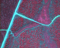
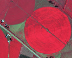
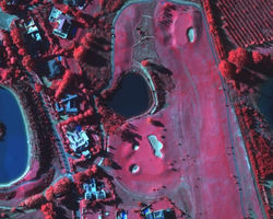
Multispectral imaging captures imagery data at specific frequencies across the electromagnetic spectrum, including frequencies which are not visible to the human eye. Multispectral imagery can allow extraction of additional information from imagery data that the human eye fails to capture with its receptors for red, green and blue. Multispectral aerial imagery data can be particularly useful for gathering data on land cover and land cover change.
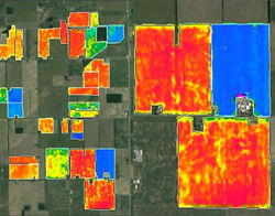
LRI employs a variety of aerial remote sensing imagery technologies to deliver multispectral imagery and a proprietary calibrated Normalised Difference Vegetation Index (NDVI) mapping solution to our clients. NDVI mapping is a powerful tool within the agricultural sector to maximize crop performance. Typical uses of our proprietary NDVI mapping solution are:
-
To define harvest areas and to ensure equal quality and ripeness in harvest blocks
-
To understand positive and negative variables impacting crops
-
To aid in resource allocation by vigour areas such as fertilizing, pesticide and irrigation applications
-
To monitor the effect of management decisions and goals through change detection
NDVI Mapping Explained
NDVI (Normalised Difference Vegetation Index) is one of many vegetation indices extracted from multispectral aerial imagery data collected by aerial or satellite cameras and which depict the vigour of live vegetation. NDVI is calculated as the difference between reflected near infrared and red light. In short, as leaf area and chlorophyll content increase, the difference between reflected infrared and red light also increases. Consequently, crops will show increasing NDVI values as their Gross Primary Productivity increases. NDVI is a normalised index, which means its values always span the same range (from -1 to 1). This corrects differences due to illumination allowing quantitative comparisons between values obtained at different dates or times. Our calibrated NDVI mapping is grouped into classes with a colour assigned to each class so that similar NDVI values show similar colours. This allows quick, easy and accurate assessment of variability within your crops.
LRI’s multispectral aerial imagery and proprietary calibrated NDVI mapping is a powerful tool to maximize crop performance.

 |  |  |  |
|---|---|---|---|
 |  |  |

